THE EAST BAY WALLS:
Of all of the stone line clusters the most famous is The East Bay Walls. Far more has been written about The East Bay Walls 30 +\- miles of stone lines than all of the other 770+ miles of stone lines in the state put together.
LOCATION:
The East Bay Walls consist of 4 separate clusters and a few scattered miscellaneous stone lines. These clusters are in an area about 45 miles long and 5 miles wide.
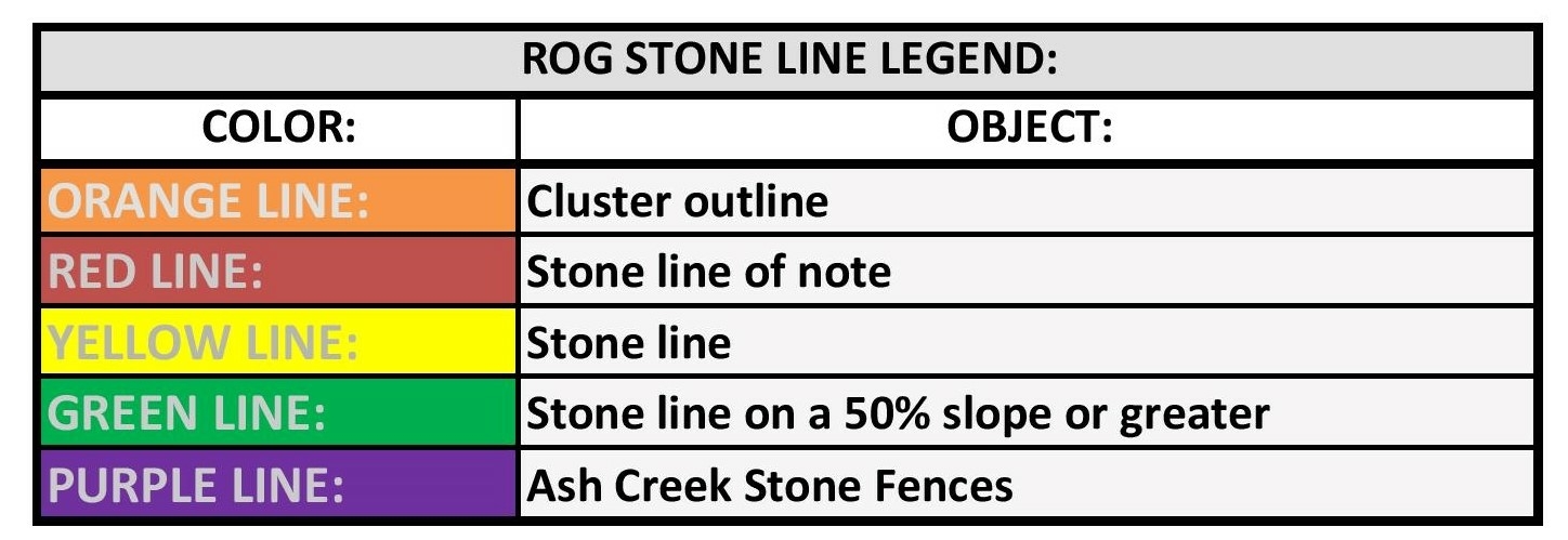
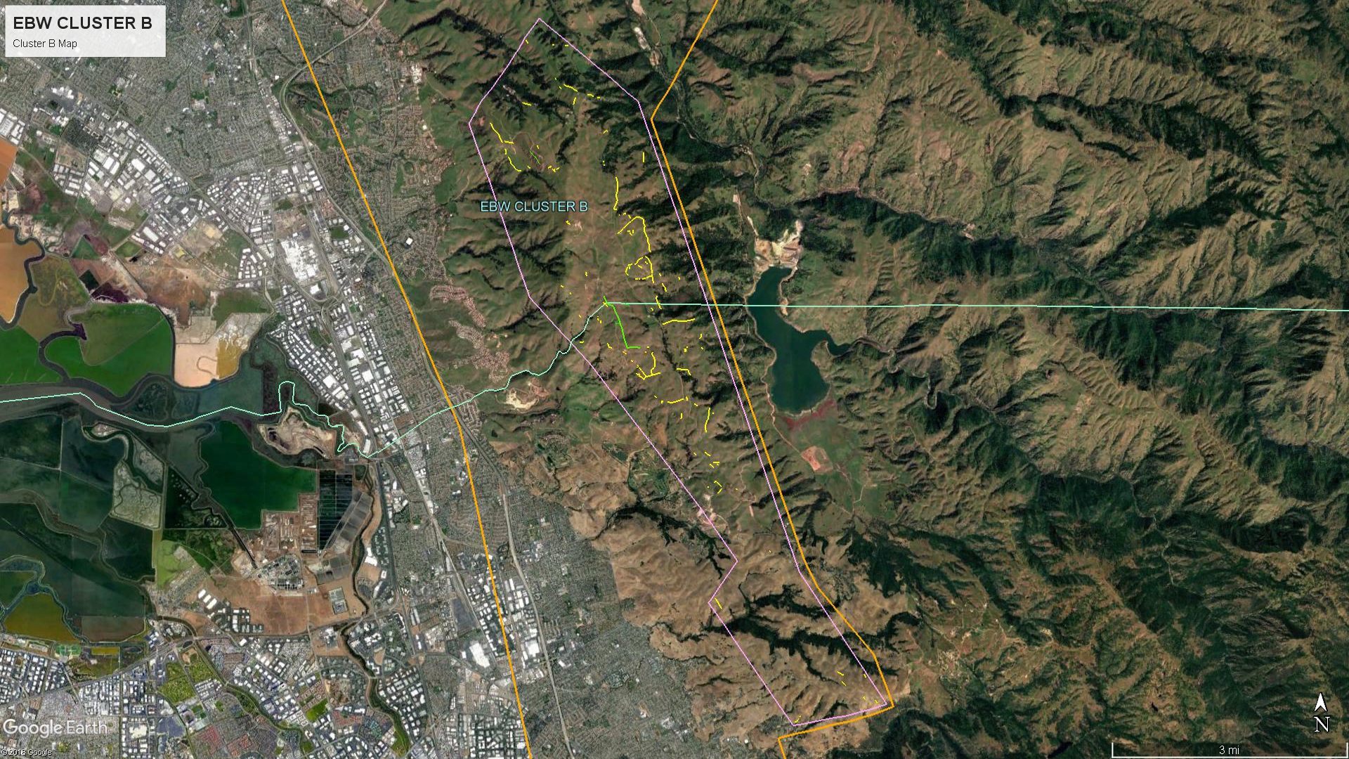
Map Legend:
Yellow = Stone line
Green = Stone line on a 50%+ grade (Steep)
Peach = East Bay Walls Area Boundary
Light Blue = Cluster Boundary
Click images for full size map.
MAP LEGEND:
EAST BAY WALL CLUSTER LOCATIONS:
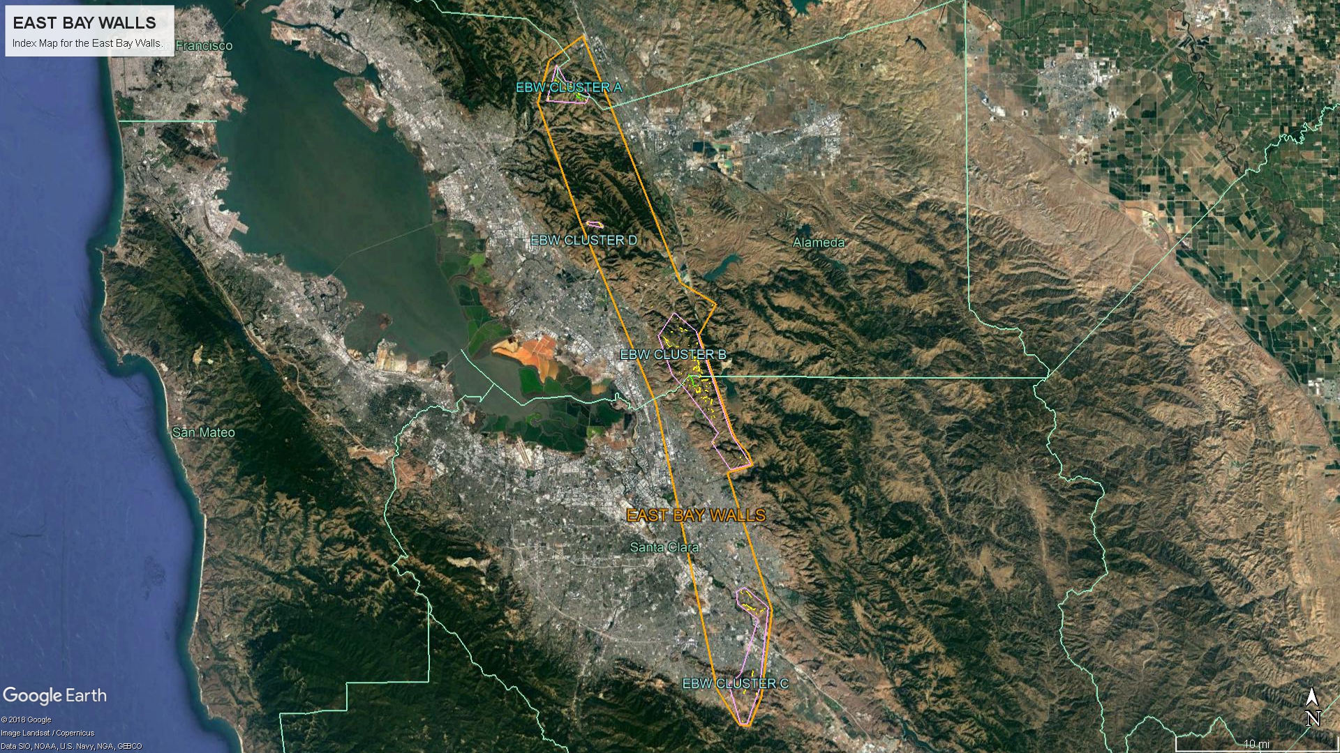
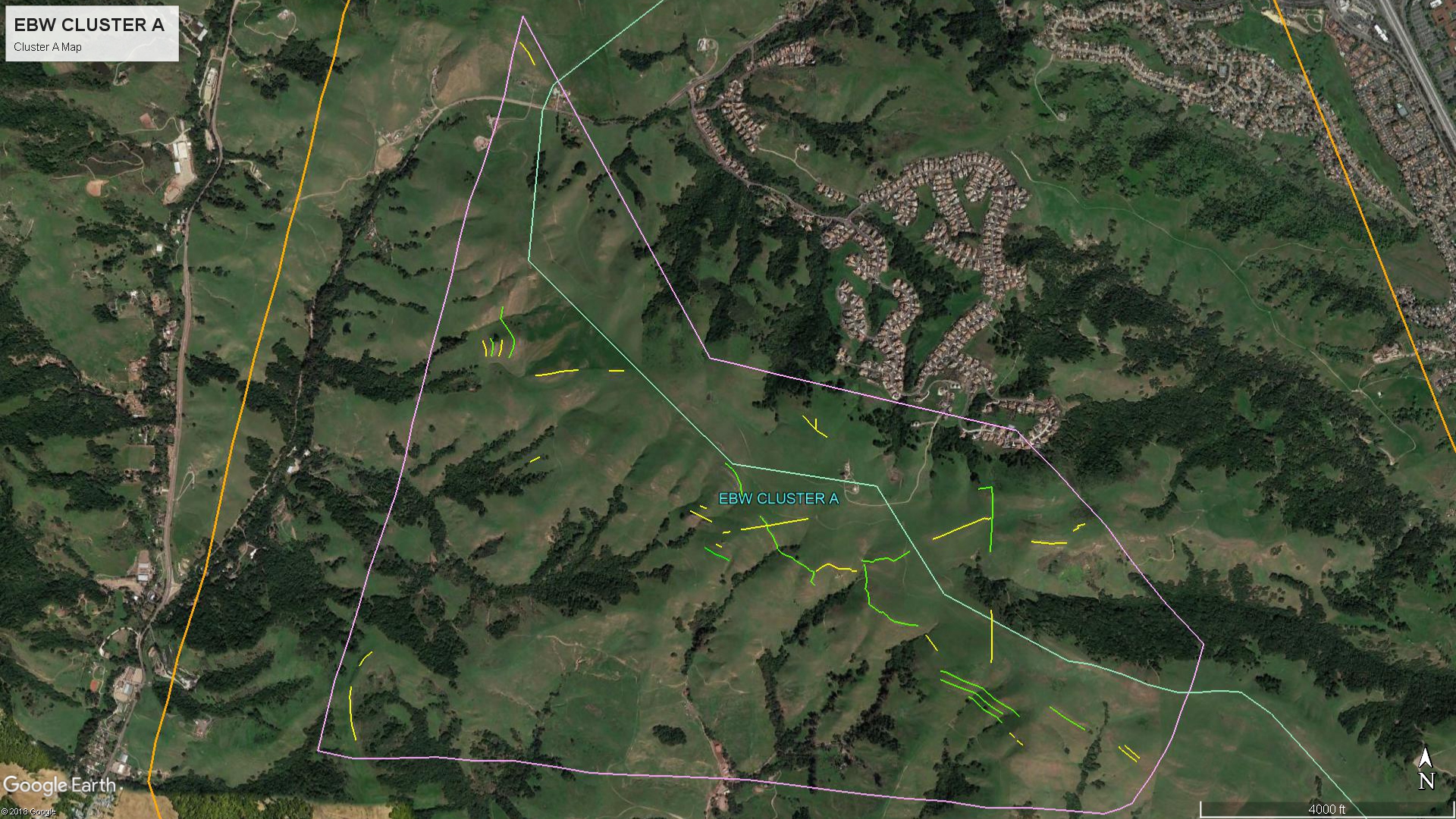
CLUSTER A.
CLUSTER B:
Cluster B is the largest cluster and the area most commonly associated with the name East Bay Walls.
CLUSTER C:
Cluster C is composed of two small clusters separated by developed land.

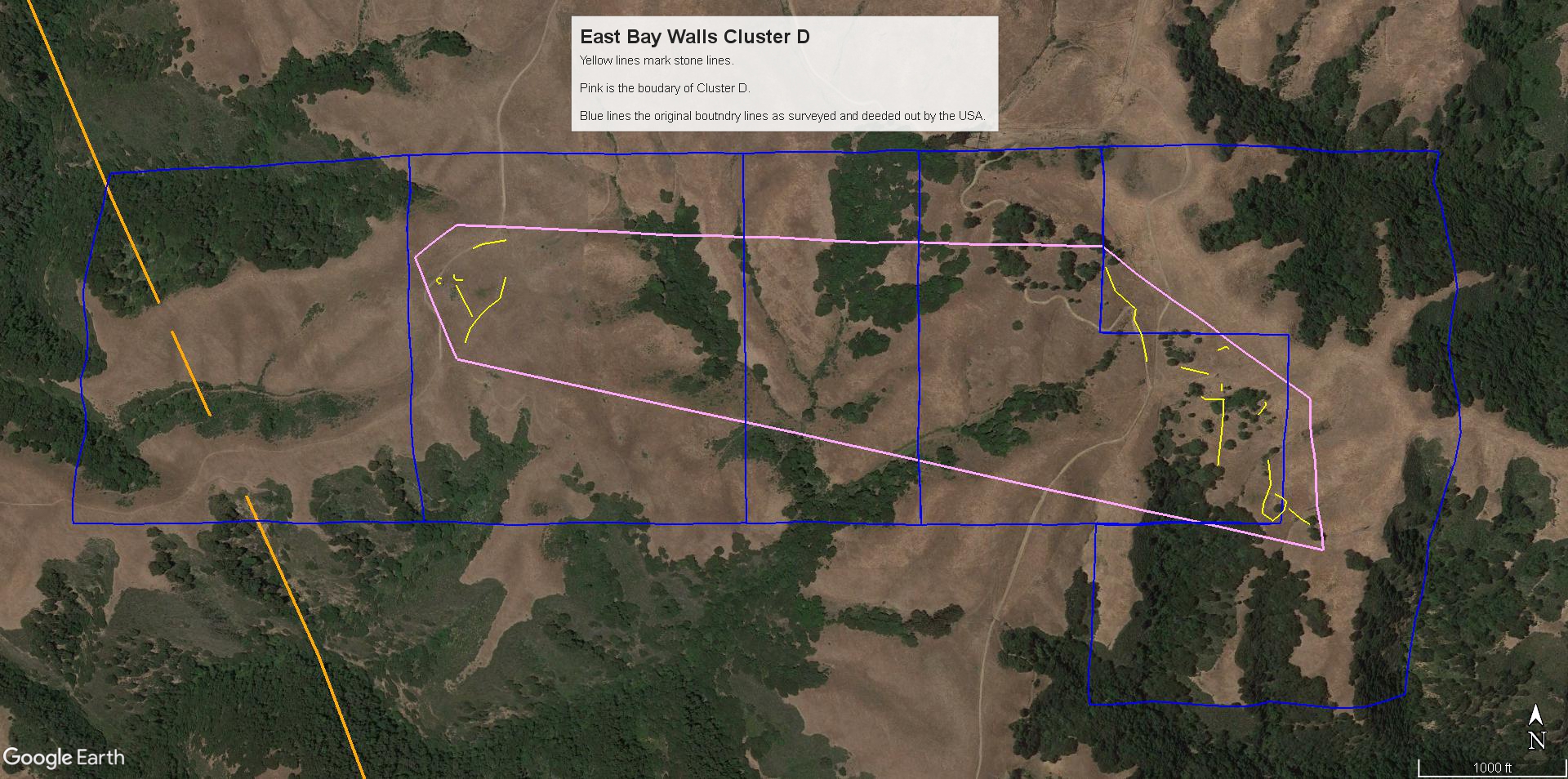
CLUSTER D:
Cluster D is the smallest cluster with only a few lines.